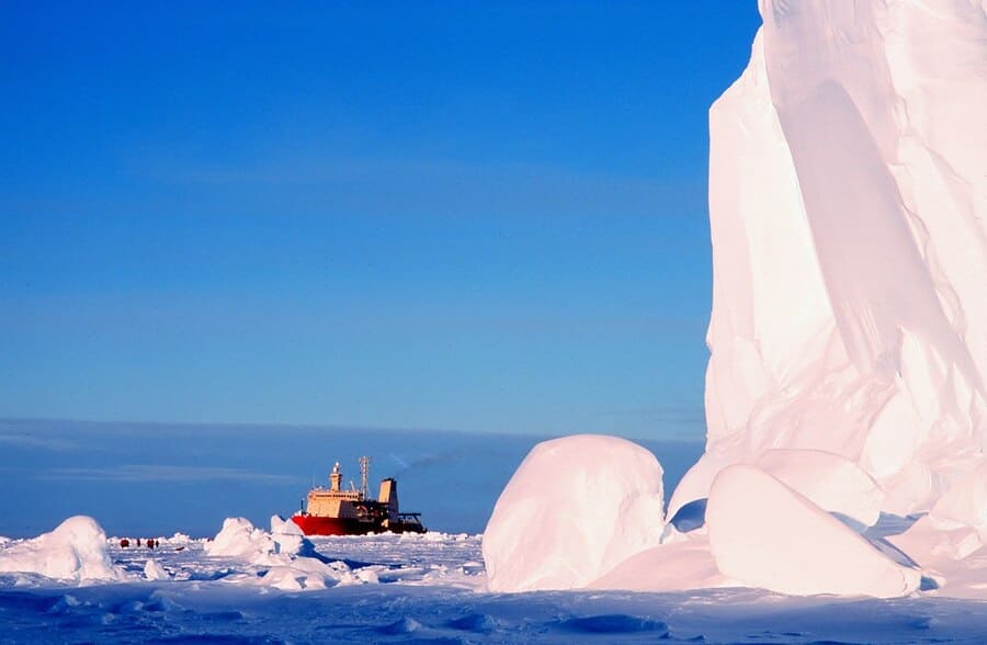
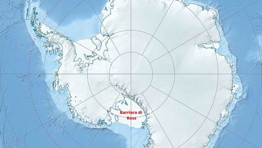
The Ross Barrier is a huge ice shelf, about 970 km long and 800 km wide, almost the size of France. It is located in the Ross Sea in Antarctica. Its height above sea level ranges from a minimum of 15 meters to over 50 meters.
British Captain James Clark Ross discovered the barrier in 1841. In January 1841 two British ships the HMS Erebus and HMS Terror, had been commissioned to discover the magnetic South Pole. The ships following their course south were confronted with a very high ice barrier barring their path. They set out to skirt the ice shelf, traveled hundreds of miles but found no passage to navigate further south.
The barrier was later given the name Ross and so was Ross Island and the Ross Sea. Instead, it was Ross himself who named the two volcanoes on Ross Island after his 2 vessels, Erebus and Terror.
Today the Ross barrier is a major tourist destination. Boats take tourists almost all the way under the ice wall so that they can assess the proportions and true size of the reef. Even more impressive is knowing that the emerged part of the reef is nothing compared to the submerged part. The last time a study was done on this, it was estimated to be about 750 meters deep.
A reef that continues to grow
The size of the Ross barrier grows larger every year. It is fed by ice flowing down from glaciers and into the sea, where it floats in the water and joins the existing shelf. It is estimated that every day the platform grows by about 1.5 meters. The function of the Ross barrier is very important in that on the one hand, it acts as a brake on excessive icefalls from the mountains and on the other hand, it prevents the water contained in the ice from being lost to the sea.
Several glaciers in the Transantarctic Cordillera feed the Ross Barrier, and it is estimated that just as the shelf increases in size, it also increases in height.
It can happen that deep crevasses open in the barrier. In such cases, it may happen that the structure breaks down and an iceberg breaks off. Similar facts have happened before. The best known was the B-15A iceberg that broke off from the Ross Barrier in the year 2000. Its size was the size of Belgium, and it weighed 3 billion tons. It was the largest iceberg ever recorded. Through the placement of GPS, it was possible to track the drift of the iceberg throughout its entire course. It split in 2002, but the largest piece continued to be considered a hazard to navigation. Finally, in October 2005, following repeated collisions with the Antarctic coast, the iceberg broke into 9 pieces. In 2006, a piece of the iceberg sized 60km was spotted near the coast of New Zealand. In 2018 there were still 4 pieces measuring at least 70km in the South Atlantic near the Falkland Islands and South Georgia.
Some ruptures have alarmed experts
In 2002, the University of Colorado had undertaken a study of ice shelves in order to assess their stability. Some ruptures that had occurred in the Ross Barrier and Larsen B had ignited alarm bells. The study concluded that the platforms, even at the points thought to be the “warmest,” retain a temperature several degrees below that which would lead to ice melting. Therefore, the fracture phenomena that had led to the detachment of iceberg B-15A and other minor ones are not related to the stability of the platforms.
An investigation in the year 2006, after analyzing the archaeological findings, suggested that, in the distant past, the Ross barrier had suddenly collapsed and that such an event might recur.
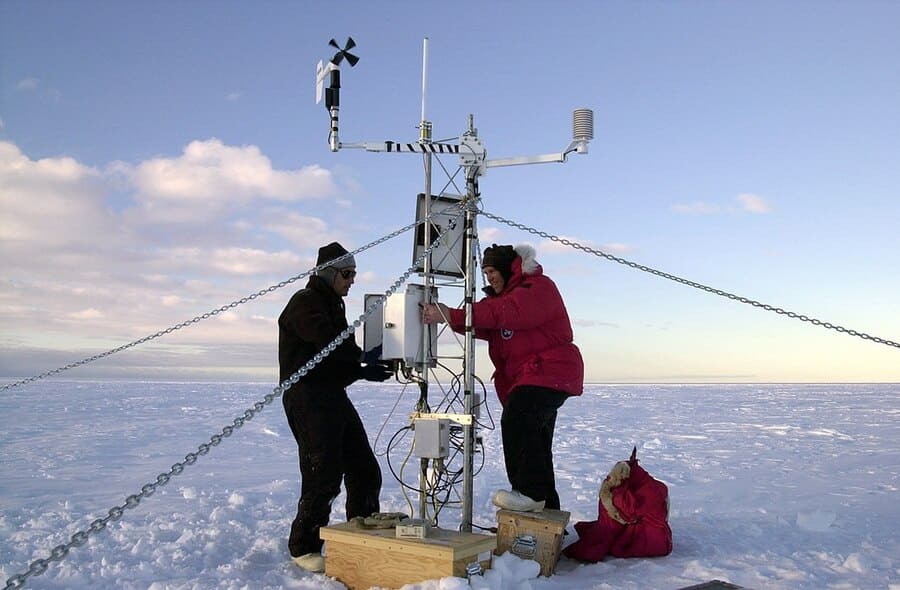
The Ross Barrier is constantly monitored
This hypothesis was also validated by research carried out in 2018. A group of scientists from New Zealand landed with a helicopter in the central area of the Ross Barrier. Using a drill and a machine that threw hot water, they drilled through the ice a full 335 meters deep. Then they lowered various instruments into the tunnel, to analyze the water, study the currents under the ice, the temperature of the water under the shelf, and so on. What was immediately noticed was that the water under the platform tended to freeze, rather than melt the platform. Therefore, for the time being, it is not likely that the platform could have melting principles.
However, what we do know for now, based on microorganisms found in the deep ice layers, is that the Ross shelf may have fractured and then melted nearly 400,000 years ago. Posteriorly it would have refrozen, and then collapsed again about 120,000 years ago, a time when temperatures were almost the same as we have now.
If the collapse actually happens someday, it should not take us by surprise. Supposedly, the instruments that New Zealand scientists have lowered into the depths of the shelf should warn us sooner.
